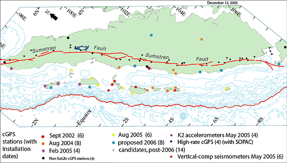
As of August 2005, the SuGAr
network consisted of 24 permanent stations along the Sumatran
plate boundary(Figure 1).
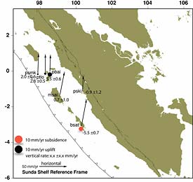
Prior to the giant Aceh-Andaman earthquake of December 2004,
the SuGAr network was showing steady convergence of the outer-arc
islands toward the mainland coast (Figure
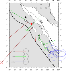
2). During the Aceh-Andaman earthquake, the network
recorded sub-centimeter motions toward the south and east.
During the Nias-Simeulue earthquake of March 28th, stations
from the Equator north recorded substantial motions (Figure
3).