 |
 |
 |
|
Funded
in part by  |
TECTONIC CONTEXT FOR THE
MARCH 28, 2005 BANYAK ISLANDS EARTHQUAKE
Map information UPDATED 16 APRIL 2005 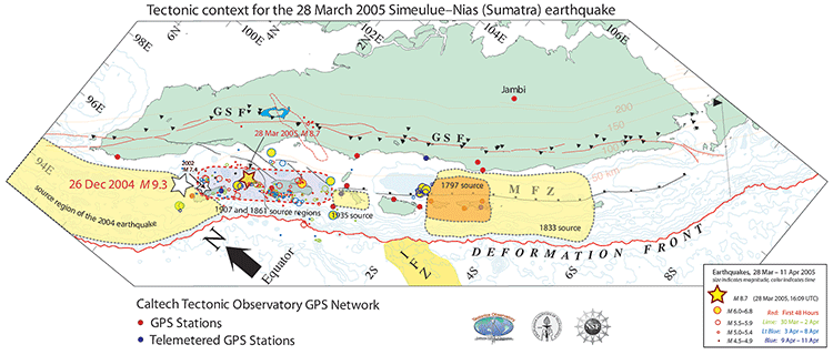
view larger image :: ![]() Download
Download![]() pdf,
prints 16.5"w x 7"h
pdf,
prints 16.5"w x 7"h
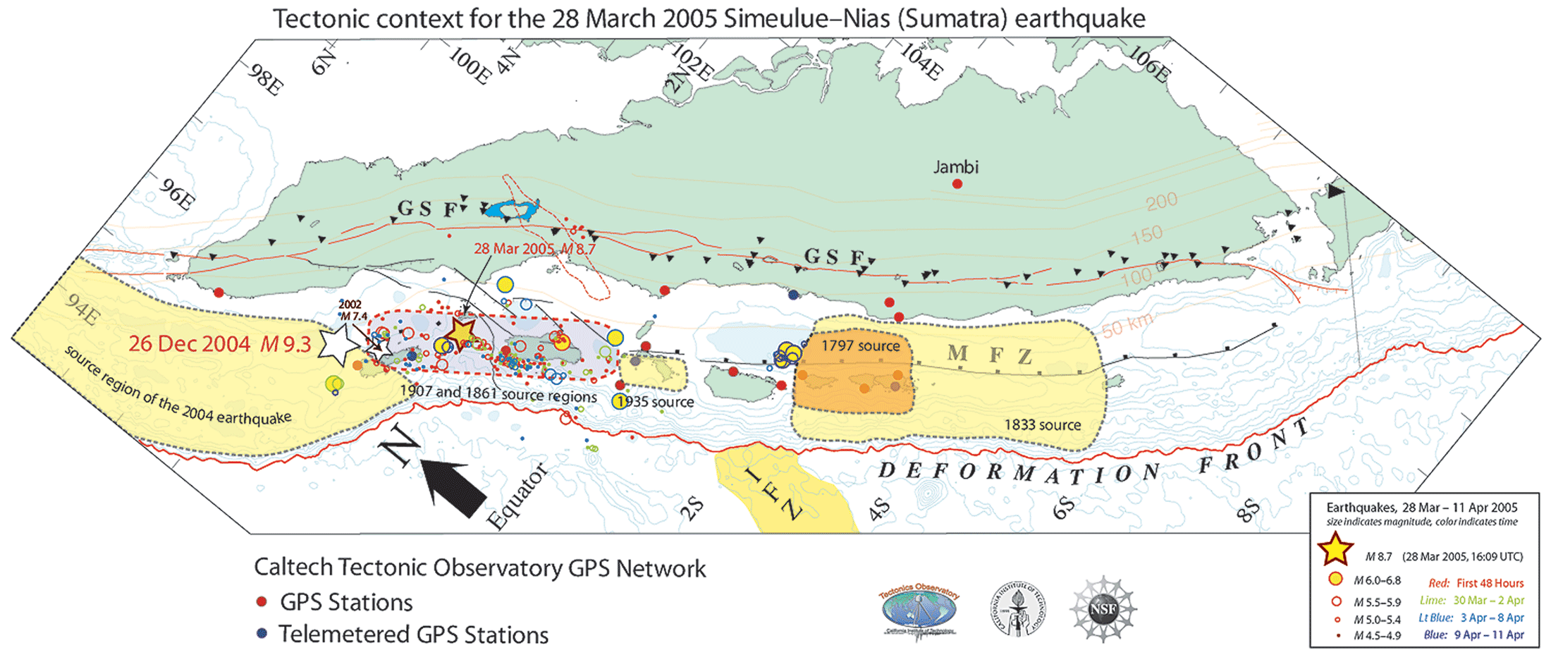
This map shows the inferred rupture area of the March 28, 2005 M 8.7 Banyak Islands earthquake with respect to large ruptures of the Sumatran megathrust in the past two centuries. Preliminary aftershock data show that the rupture extended from the southeastern limit of the 2004 M 9.3 Aceh/Andaman earthquake to the equator, a minimum distance of 300 km. Large earthquakes in 1907 and 1861 occurred along this portion of the megathrust.