 |
 |
 |
|
Funded
in part by  |
Magnitude
6.3 - SOUTHERN SUMATRA, INDONESIA
|
|
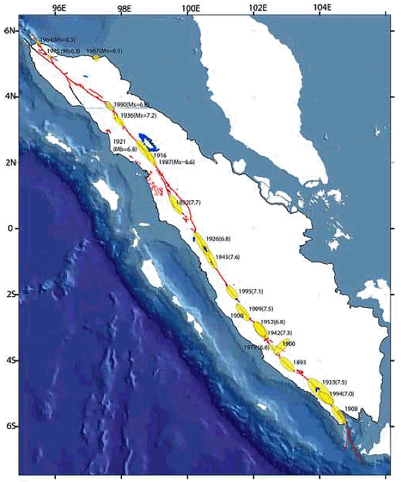
From Kerry Sieh, in Singapore, 9:30 pm, March 6. The earthquakes on the morning of March 6th (Indonesian time) resulted from slip along the Great Sumatran fault, north of the large city of Padang, in the province of West Sumatra. The Great Sumatran fault traverses the entire 2000-km length of Sumatra, from Banda Aceh on the north nearly to the volcano Krakatau in the south. It has been the site of many earthquakes ranging up to about magnitude 7.5, especially in the period between 1892 and 1953. Smaller earthquakes, like those on March 6th, occur irregularly but about every decade or so, somewhere along the fault. Slippage along the fault is horizontal, like the San Andreas fault in California. |
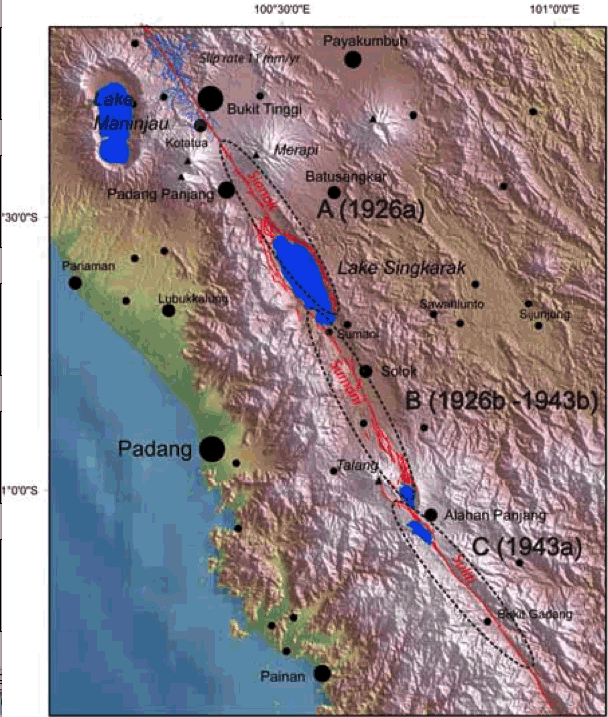
The two figures below show the location of the fault and some of its historical earthquakes. These figures are from a presentation being given at the National University of Singapore on March 7th by Dr. Danny Hilman Natawidjaja of the Indonesian Institute of Sciences (LIPI) in Bandung, Indonesia. Dr. Natawidjaja earned his Ph.D. at Caltech in 2003. The earthquakes of March 6th originated from the fault zone near the north end of Singkarak Lake, about 45 km north of Padang. For more information on the Great Sumatran fault, please read this paper, published in the Journal of Geophysical Research in 2000 |
 |
|
 |
|