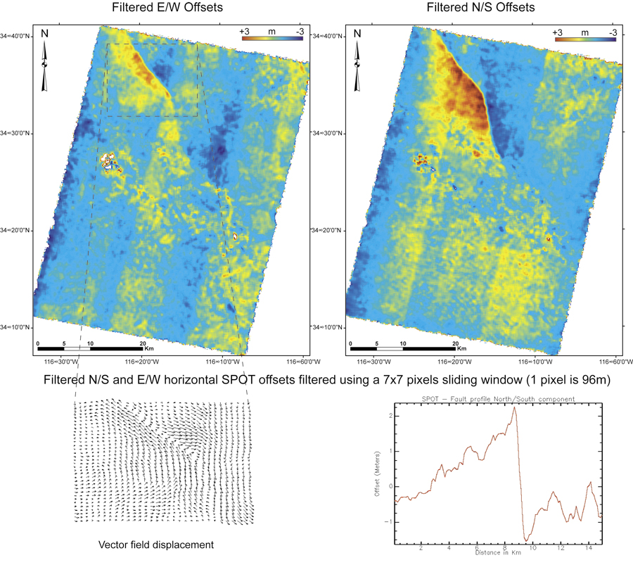
The 1999 Hector Mine, California earthquake seen from SPOT images
SPOT 4, acquisition date: 08-17-1998
Ground resolution: 10m
SPOT 2, acquisition date: 08-18-2000
Ground resolution: 10m
Correspond to sub-pixel offsets in the raw images.
Correlation windows: 32 x 32 pixels
96m between two measurements
Funded in part by National Science Foundation grants EAR 0409652 & 0636097