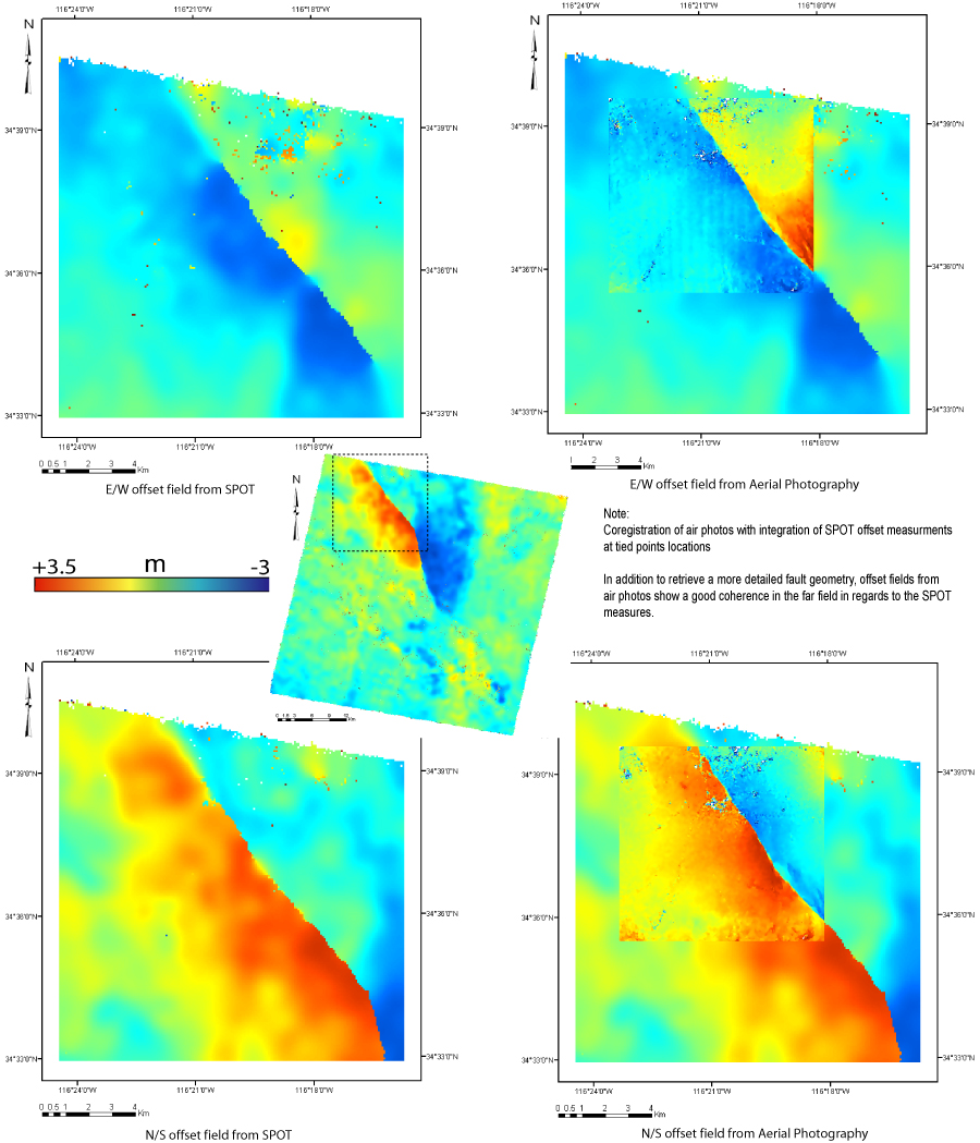
The 1999 Hector Mine, California earthquake seen from SPOT and Aerial images
Pre-earthquake image:
SPOT 4, acquisition date: 08-17-1998
Ground resolution: 10mPost-earthquake image:
SPOT 2, acquisition date: 08-18-2000
Ground resolution: 10mOffsets meaured from correlation:
- 320m x 320m correlation windows
- 80m between two measurements
Pre-earthquake image (USGS-NAPP):
Acquisition date : 7/25/89
Ground resolution : 1mPost-earthquake image (USGS-NAPP):
Acquisition date : 06/01/02
Ground resolution : 1mOffsets meaured from correlation:
- 128m x 128m correlation windows
- 16m between two measurments
Funded in part by National Science Foundation grants EAR 0409652 & 0636097