Applying
the precise rectification algorithm + subpixel correlation:
The 1999 Hector-Mine
earthquake (Mw 7.1, California)
Horizontal Co-seismic deformation retrieved from SPOT imagery:

Obtaining the Data (available in ENVI
file Format. Load banbs as gray scale images. Bands are: N/S offsets,
E/W offsets, SNR):
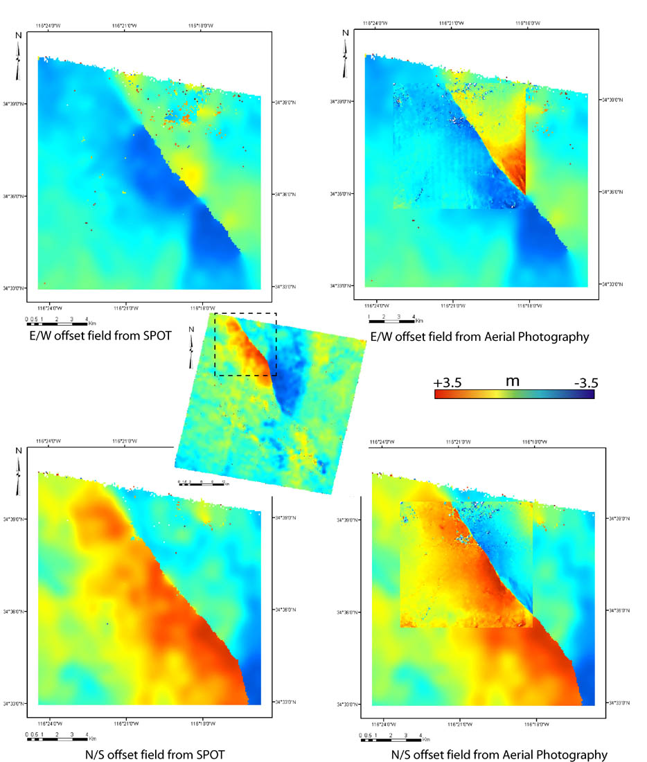
Raw and filtered results: HectorMine.zip
Pre-earthquake
image:
SPOT 4, acquisition date: 08-17-1998
Ground resolution: 10m
Post-earthquake
image:
SPOT 2, acquisition date: 08-18-2000
Ground resolution: 10m
Offsets
measured from correlation:
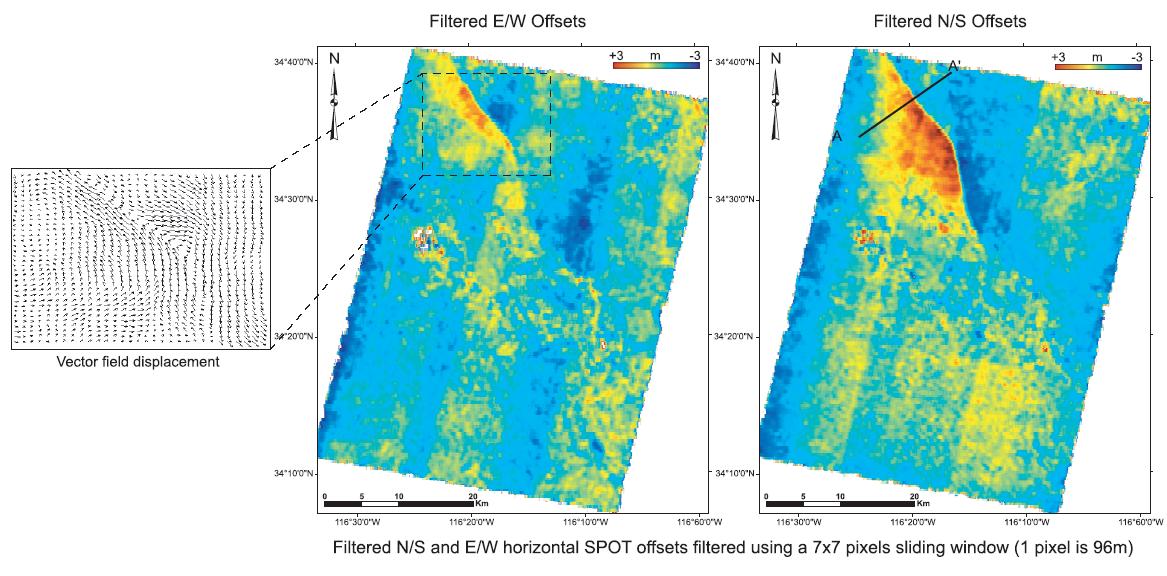
Correspond to sub-pixel offsets
in the raw images.
Correlation windows: 32 x 32 pixels
96m between two measurements
SPOT and Aerial photography complementarity: